Drone Surveying Perth | Fast, Accurate Site Data

Drone Surveying Perth That Keeps Projects Moving
Drone surveying in Perth gives builders, developers and civil project teams a faster, clearer view of large or complex sites. Instead of relying only on individual measurements taken from ground level, a drone can capture detailed aerial information across an entire project area.
That information can then be processed into practical survey outputs such as aerial site plans, point clouds, contours, surface models, volume calculations and three-dimensional visualisations.
The real value is not simply having impressive aerial images. It is having clear, accurate site information that helps your team make decisions, coordinate work and keep the project moving.
Perth Surveying plans each drone survey around the decision your team needs to make. You receive clear timelines, controlled data capture and project-ready information that helps keep work moving. The real value is not simply having impressive aerial images. It is having clear, accurate site information that helps your team make decisions, coordinate work and keep the project moving.
What Is Drone Surveying

Drone surveying uses an unmanned aerial vehicle fitted with specialist cameras or sensors to collect information from above a site.
During the flight, the drone captures overlapping site imagery or sensor data across the defined project area. Specialist software then combines that information to create a detailed digital representation of the site. Where controlled survey outputs are required, ground control and field verification connect the aerial data to the project coordinate system and intended use.”
The resulting data can provide a broader view than traditional site photography. It can show changes in ground levels, existing structures, site access, stockpile locations, earthworks progress and other visible site conditions.
From Aerial Images to Useful Site Information
A drone survey is different from standard aerial photography.
Standard drone photography records what a site looks like. A drone survey is planned around accuracy, site conditions, flight coverage, survey control, processing and the way the final data will be used.
The project brief determines what should be captured and how the information should be delivered.
A builder may need a current surface model before earthworks begin. A developer may require site contours for early planning. A civil contractor may want regular volume comparisons. An architect may need a clear aerial context to support the design process.
Every deliverable should match the decision your team needs to make, whether that is planning earthworks, checking volumes, coordinating design or documenting progress.
Drone Surveying and Ground Surveying
Drone surveying complements rather than replaces ground-based surveying.
Ground-based instruments remain important where particular points require close measurement, where site features are hidden from the air, or where the work involves legal land boundaries. Legal boundary definition requires appropriate cadastral surveying methods and should not be based on aerial imagery alone.
For many projects, the most reliable approach combines aerial coverage with GNSS, total station measurements, laser scanning or field verification. Perth Surveying selects the capture method around the required accuracy, visible site conditions and intended project use.
This combined approach provides broad aerial coverage while maintaining control over important site details.
When Drone Surveying Makes Sense
Drone surveying can be particularly valuable when a project involves a large area, difficult access or a significant amount of visible surface information.
Planning and design
- Existing-condition surveys
- Topographic mapping
- Development feasibility investigations
- Contours and 3D site models
Earthworks and civil works
- Cut-and-fill assessments
- Stockpile volume calculations
- Road and drainage projects
- Quarry, industrial and regional sites
Construction monitoring
- Progress records
- Site inspection support
- Comparison against design surfaces
- Large residential development areas
Large or Difficult Sites
Walking an entire site and measuring every visible feature can be time-consuming, particularly when the land is large, uneven or difficult to access.
A planned drone flight can capture broad site coverage efficiently while reducing the amount of ground that must be accessed on foot. This can reduce the time spent moving through difficult terrain while providing a clear overall view of the project area.
It can reduce the time survey personnel spend near active machinery, steep batters or unstable ground, subject to the project safety plan and site conditions.
Site conditions still need to be assessed before the flight. Trees, buildings, powerlines, nearby airports and public access can all affect how the work should be planned. For regional WA sites, access, travel requirements, communications coverage and local operating conditions should be confirmed early.
Earthworks and Volume Tracking
Earthworks can change quickly. A surface recorded at the beginning of the month may look very different after several weeks of excavation, filling or stockpile movement.
Drone surveying can create a digital model of the visible ground surface. When surveys are captured to a consistent scope and control, the datasets can be compared to measure how the visible site surface has changed over time.
This information may support
- Cut and fill planning
- Stockpile volume calculations
- Progress claims
- Contractor coordination
- Material movement records
- Comparison against design surfaces
- Identification of unexpected site changes
Regular capture can create a consistent record throughout the project rather than relying on disconnected photographs or informal observations. For repeat earthworks monitoring, agree the capture frequency, base surface, reporting boundaries and required output format before the first survey.
Construction Progress Records
Aerial data can help stakeholders see the relationship between different areas of a site.
For example, a project manager may need to review access routes, retaining work, drainage areas and material storage at the same time. A current aerial model can make those relationships easier to understand.
Repeat aerial surveys give consultants, clients and remote stakeholders a consistent visual and measurable record of construction progress. Using a consistent capture area and viewing format makes changes between project stages easier to identify and communicate.
What You Can Receive From a Drone Survey
Before attendance, Perth Surveying confirms the required outputs, accuracy, coordinate system or datum, such as GDA2020. and file formats with your team. This ensures the site is captured for a defined project purpose and avoids unnecessary or unusable data. Depending on the scope, deliverables can include:
Orthomosaic Site Imagery
An orthomosaic is a group of aerial images processed into one scaled overhead image.
Unlike a single drone photograph, an orthomosaic is corrected to provide a consistent top-down representation of the site. It supports site review, design coordination and progress comparison by showing visible features in a consistent scaled view.
Three-Dimensional Point Clouds
A point cloud is a digital collection of measured points representing the visible surface of the site.
The points can show terrain, structures and other captured features in three dimensions. Point clouds support 3D modelling, measurement, design coordination and detailed visual review where the selected software and file format are compatible.
Contours and Surface Models
Contour plans show changes in elevation across the land.
Digital terrain and surface models represent site levels for analysis, earthworks planning and design coordination. Perth Surveying will confirm which model is appropriate based on the visible surface, required accuracy and intended use.
The correct model depends on what is visible, what must be measured and how the final information will be used.
Volume Calculations
Processed survey data can support the calculation of visible stockpile volumes or changes between surfaces.
Accurate results depend on having a suitable base surface, clearly defined boundaries and appropriate survey control. For repeat measurements, the calculation boundary and comparison surface should remain consistent wherever practical.
CAD and Digital Data
Depending on the scope, information may be supplied in formats suitable for architectural, engineering, construction or geographic information system workflows.
Perth Surveying provides digital plans and data designed to support practical project coordination. File formats are confirmed during quoting so builders, engineers, architects and consultants receive data suited to their software and responsibilities.
How Our Drone Surveying Process Works
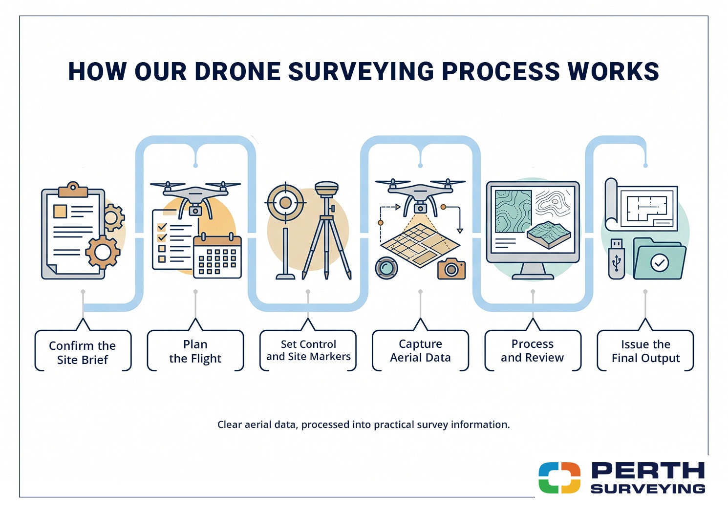
A reliable drone survey begins before the aircraft leaves the ground.
Our team plans the work around your site, project stage, required accuracy and expected deliverables.
Our five-step process
- Define the project scope and required outputs.
- Review the site, access and flight conditions.
- Establish survey control where required.
- Capture and verify the site data.
- Process, check and deliver the agreed files.
Confirming the Project Scope
We begin by identifying what your team needs to achieve.
This may include confirming
- The project location
- The area to be captured
- The purpose of the survey
- The required outputs
- The preferred file formats
- The required survey accuracy
- The relevant design information
- Site access requirements
- The required delivery timeframe
A clear scope avoids unnecessary capture and ensures every deliverable supports a defined project decision.
Reviewing the Site and Flight Requirements
Every site presents different conditions.
Our team reviews access, surrounding development, nearby infrastructure, vegetation, airspace restrictions and other factors that could affect safe data capture.
Each flight is planned around site access, surrounding infrastructure, operating conditions, airspace and applicable CASA requirements. Some locations or operating conditions may require additional planning or approval.
Establishing Survey Control
Where the project requires controlled survey outputs, suitable ground control or verification points may be established.
These points help relate the aerial information to the project coordinate system and required datum.
The control method is selected according to the site, required accuracy, project datum and intended use of the final data.
Capturing the Site
The drone follows a planned flight pattern to capture overlapping coverage across the required area.
The operator monitors the aircraft, the surrounding conditions and the quality of the capture throughout the flight.
Large, complex or obstructed sites may require multiple flights or supplementary ground measurements to achieve the agreed coverage and output.
Processing and Checking the Data
The captured information is processed into the agreed outputs.
Our survey team checks the data for coverage, alignment, completeness and suitability before the agreed files are released. Where additional verification is required, the aerial information can be checked against measurements captured from the ground.
Delivering Clear Project Information
Final files are supplied in the agreed format, with supporting explanations where required. You receive clear, project-ready information, not a folder of unexplained technical files.
You receive information prepared for a practical project purpose rather than a folder of unexplained technical files.
Why Choose Perth Surveying
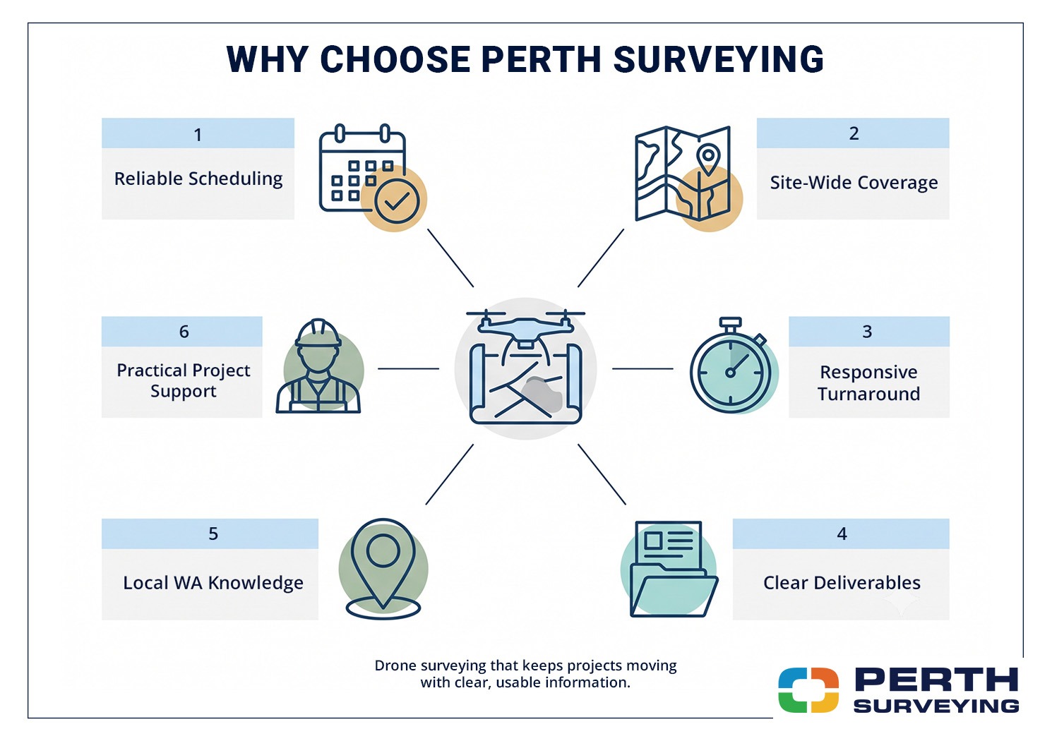
Builders and developers need more than a drone operator. They need a surveying partner who can define the scope, schedule the work and deliver information that fits the next project decision.
Builders and developers need confidence that the survey will be scheduled, the site requirements will be understood, and the information will arrive in a usable form.
Turnaround You Can Plan Around
Perth Surveying uses structured scheduling and field planning to provide clear attendance and delivery timelines.
We provide clear timelines at the quoting and booking stage. Where site conditions, approvals or weather may affect attendance, we explain those factors early.
This gives your project team a more reliable basis for coordinating consultants, machinery, contractors and upcoming work.
Clear Deliverables and Communication
Survey information often moves between several people.
A project manager may send it to an engineer. The engineer may use it with design data. The builder may need a simplified plan for site coordination.
Before attendance, we confirm the scope, expected deliverables and timeline. If site, weather or access conditions change the plan, your team receives an update.
Local WA Project Knowledge
Perth and regional Western Australia present a wide range of project conditions.
Coastal sites, urban infill projects, regional properties, active construction sites and large development areas each require a different approach.
Local WA knowledge helps our team plan around access, site conditions, regional travel, project stakeholders and practical delivery requirements.
One Surveying Partner Across the Project
Drone surveying may be only one part of the surveying required.
Perth Surveying can also support projects with construction setouts, feature and contour surveys, as-constructed surveys, volume surveys, licensed boundary work, subdivision field surveys and subdivision administration.
Using one surveying partner improves continuity between project stages, reduces repeated briefing and helps maintain consistent survey control and deliverables.
Planning a Successful Drone Survey
Providing the right information at the beginning helps the survey run smoothly.
Before requesting a quote, consider the following questions.
- What decisions will be made using the data
- Which part of the site must be captured
- Is there an existing design surface
- Is a specific coordinate system required
- Which consultants will use the files
- Are there active machines or restricted areas
- Is access controlled
- Is the site close to an airport or helicopter facility
- Does the site contain dense vegetation
- Is the survey required once or at regular intervals
You do not need to know every technical answer before contacting us.
Our team can help define the scope and recommend a practical capture method based on the project outcome.
Is Drone Surveying Right for Your Project
Drone surveying may be suitable when you need broad site coverage, current surface information or a clear visual record of progress.
It may be less suitable where the required features are hidden by buildings or vegetation, where airspace conditions restrict operations, or where the task requires precise legal boundary determination.
In those situations, another survey method or a combination of technologies may provide a better result.
The goal is not to use a drone on every project. The goal is to choose the right surveying method for the information you need.
Get Clearer Site Data Without Slowing the Job
Need current site conditions, volume data or a repeat construction progress record? Perth Surveying will confirm the right capture method, schedule and deliverables before attendance, so your team knows what to expect.
Call 08 9303 2407, email sales@perthsurveying.com.au or visit perthsurveying.com.au to discuss your drone surveying requirements.
FAQs
Can Drone Surveying Replace a Licensed Boundary Survey?
No. Drone data may show visible fences, walls and occupation features, but those features do not necessarily represent the legal property boundary.
Legal cadastral surveying work in Western Australia must be undertaken by a properly registered licensed land surveyor holding a current practising certificate.
Perth Surveying can advise whether your project requires aerial data, licensed boundary work or both.
Do I Need to Be Present During the Drone Survey?
You will not usually need to remain on-site for the full survey, provided access, site contacts and safety requirements have been arranged beforehand.
For active construction sites, we may need to coordinate with the site supervisor or nominated contact before the flight begins.
Can Drone Surveys Be Repeated During Construction?
Yes. Repeat surveys can create a consistent visual and measurable record across different stages of the project.
The capture frequency should be based on the speed of site changes and the decisions your team needs to make. Some projects benefit from milestone surveys, while others require regular progress capture.
