Land Surveys Wanneroo | Avoid Costly Site Mistakes
Land Surveys Wanneroo: Choose the Right Survey
A fence can look straight and still sit outside the legal boundary. A backyard can appear suitable for subdivision, while access, easements or site levels change the plan. A home design can also stall when the survey information is incomplete.
Land surveys in Wanneroo provide measured site facts before design, approvals, or construction begin, when changes are still easier and less expensive to make.
Before you build, extend, or replace a fence or investigate a subdivision in Wanneroo, the right survey gives you the facts needed to make a sound decision. It can confirm boundaries, record the site as it stands and give your designer or builder reliable information to work from.
A survey is more than a drawing. It provides the measured information your builder, designer or planner relies on to move the project forward with confidence.
This guide explains the main types of land surveys used in Wanneroo, when each may be required, and what property owners and small developers should check before committing money to their project. It will also help you understand what to have ready when requesting advice or a quote.
Perth Surveying can review the property address and proposed work, confirm the appropriate survey scope and provide clear information about deliverables, scheduling and cost.
Why an Early Survey Can Prevent Costly Rework?
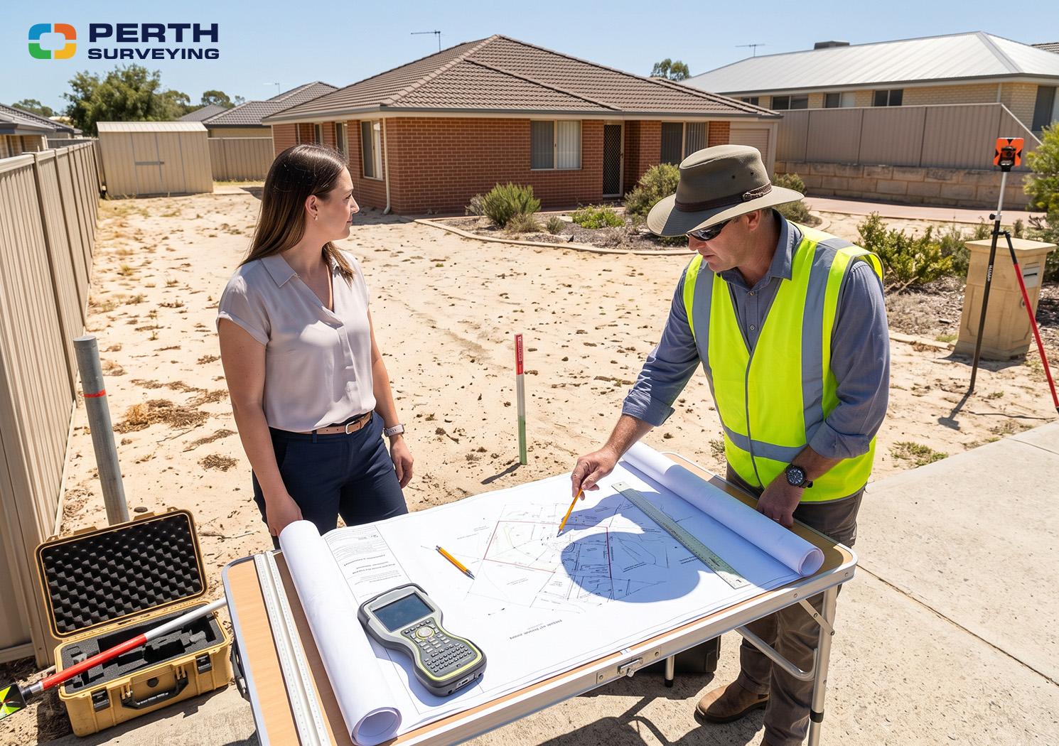
Most boundary and site information problems are inexpensive to identify early and costly to correct later. They become expensive later, after plans have been drawn, approvals have been lodged, contractors have been booked, or construction has started.
A boundary assumed from an old fence may place a new structure too close to a neighbouring property. Missing level information may force a designer to revise drainage, retaining walls or floor heights. A seemingly simple subdivision may change once access, existing buildings and restrictions on the property are properly considered.
By that stage, the cost is no longer limited to the survey. You may also be paying for redesign, new applications, delayed trades, extra engineering or work that must be moved or rebuilt.
The right survey gives your builder, designer or planner a measured foundation for the project. Potential constraints can then be identified before redesign, delayed trades or remedial construction affect the budget and program.
This is particularly important when a Wanneroo homeowner is considering a rear development, extension or small subdivision. What appears possible from the backyard may look different once the property has been measured properly.
Which Land Survey Do You Actually Need?

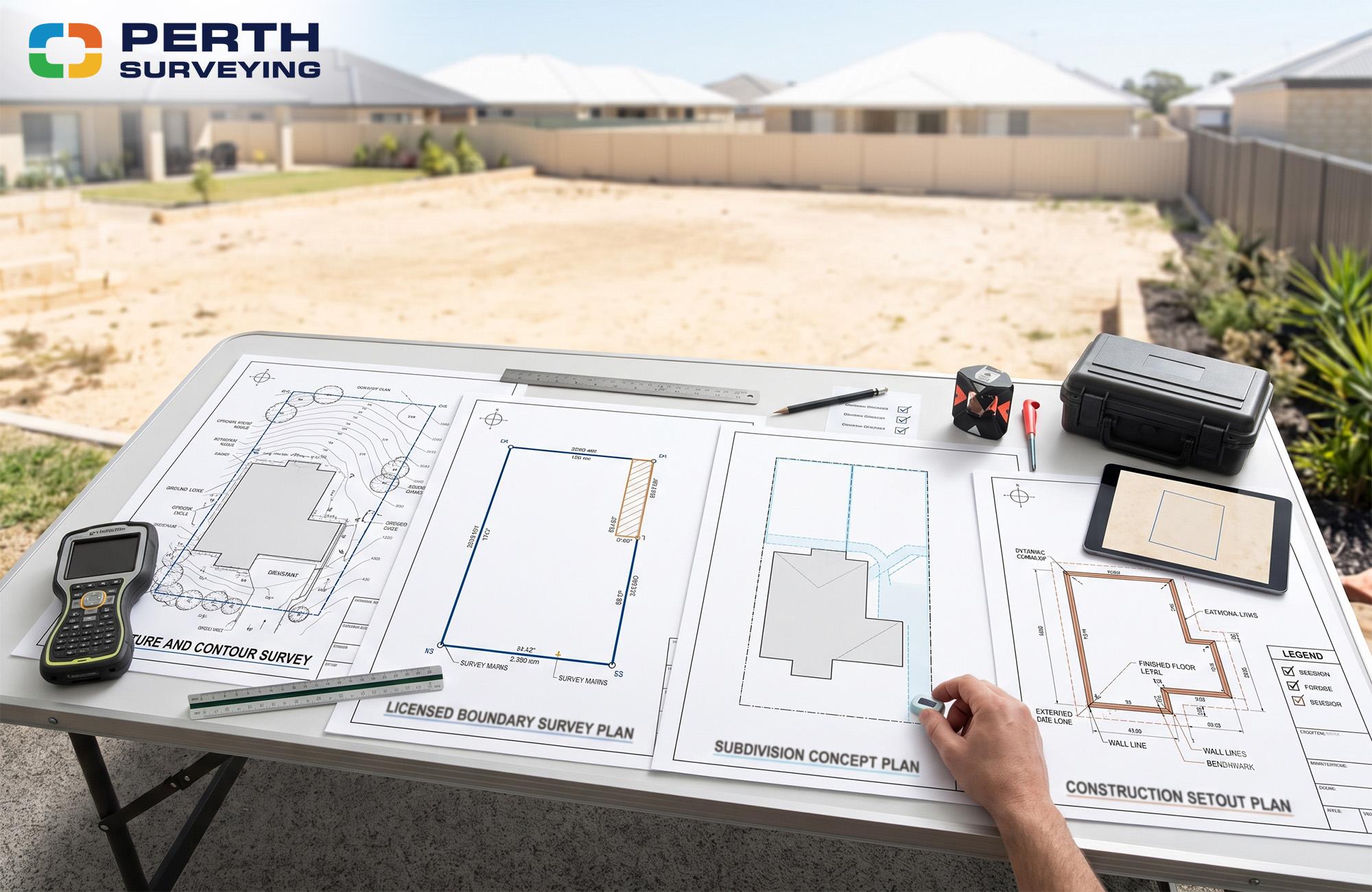
The survey you need depends on what you plan to do next. Replacing a fence, designing a home, investigating a subdivision and setting out a building each require different information. Choosing the wrong survey may leave your builder or designer without what they need to proceed.
Send Perth Surveying the property address, intended work and any requirements from your builder or designer. We will confirm the appropriate survey, required deliverables and expected timing.
Quick Survey Guide
- Designing a home, extension, pool or landscape project? Start with a feature and contour survey.
- Building or fencing near a property line? You may need a boundary survey.
- Dividing land or creating new titles? You will need subdivision surveying and administration.
- Ready to begin construction? A building setout positions the approved design on the site.
Feature and Contour Survey
A feature and contour survey records the existing buildings, visible site features and changes in ground level across the property.
It is commonly required before designing:
- A new home
- An extension or major renovation
- A granny flat
- A pool
- Retaining walls
- Significant landscaping
- A small residential development
Depending on the agreed scope, the plan can show buildings, sheds, fences, driveways, significant trees, retaining walls, visible site features and ground levels that may influence the design. The exact information included should be matched to the requirements of the architect, building designer, engineer or planner using the plan.
Perth Surveying confirms these requirements before attendance, so the completed plan provides the information the project team needs.
For a Wanneroo homeowner, this survey provides a reliable picture of the property as it exists today. It allows the designer to work from measured information rather than photographs, rough dimensions or assumptions.
The result is a clear, measured base plan that allows the designer to respond to the actual site rather than rough dimensions or assumptions.
Boundary Survey
A licensed boundary survey establishes the location of the legal property boundaries on the ground. It may be needed when:
- Building close to a boundary
- Constructing or replacing a fence
- Planning an extension
- Installing a pool, shed or retaining wall
- Investigating a possible encroachment
- Boundary pegs are missing or unclear
- The position of an existing fence is uncertain
A fence is not proof of a legal boundary.
It may have been placed for convenience, replaced without a survey or built using old or incomplete information. Finding that difference before work begins is far easier than resolving it after construction.
A boundary survey provides the owner, neighbour, builder and designer with a dependable reference before a fence, wall or building is positioned.
Subdivision Surveying and Administration
Subdivision surveying is required when a property is being divided, lot boundaries are changing, or new titles are being created.
This may include:
- Creating a rear lot
- Dividing one property into two or more lots
- Retaining the existing home and developing part of the land
- Creating survey-strata lots
- Creating green-title lots
- Adjusting a boundary between adjoining properties
Perth Surveying can support both the field surveying and subdivision administration stages, providing clear information about deliverables, timing and the next action required. Where planning, engineering or authority input is needed, this can be identified early.
For homeowner developers, a subdivision can appear simpler from the backyard than it does once the title, access, site conditions and approval requirements are examined.
The block may look large enough. There may appear to be room beside the existing house. But lot dimensions are only part of the decision. Access, existing buildings, easements, ground levels, servicing, planning requirements and the shape of the proposed lots can all affect the result.
Perth Surveying can help you understand the surveying work involved and provide the information needed for the next stage. Some properties may also require advice from a planner, engineer, designer or relevant authority.
A survey cannot guarantee subdivision approval. Its role is to establish the site facts and survey information needed for informed planning and the next approval stage.
Building Setout Survey
A building setout transfers the approved building position from the construction plans onto the property.
It gives the builder clear reference points so the home, extension or other structure can be constructed in the intended location.
A setout is commonly arranged once the design and approval stages are complete and construction is ready to begin. It marks the approved building position before footings, slabs or other structural work begins.
Perth Surveying confirms the setout scope and expected attendance timing so the builder can coordinate the next construction activity.
At the outset, accurate positioning protects the construction program and reduces the risk of boundary or compliance issues.
A setout error can place the building too close to a boundary or cause problems for the work that follows. Correcting that error after concrete has been poured is far more costly than establishing the position accurately beforehand.
The right survey depends on the next project stage. Provide the property address, a brief description of the work and any plans or consultant requirements. Perth Surveying will then confirm the survey scope, clear deliverables and expected timing before attendance is scheduled.
Why Wanneroo Property Owners Should Check Before They Commit?
A large backyard does not automatically mean an easy subdivision. Wide side access does not guarantee a workable driveway, and an existing fence does not prove where the legal boundary sits.
Across the City of Wanneroo, properties can vary significantly in lot configuration, existing development, access and site levels. Two blocks with a similar land area may offer very different options once the home position, boundaries, title interests and practical access are measured.
That does not mean an idea cannot proceed. It means the property should be assessed before detailed plans, applications or construction costs are committed.
The better question is not simply, “Can this block be divided?”
It is, “What do we need to confirm before spending money on the idea?”
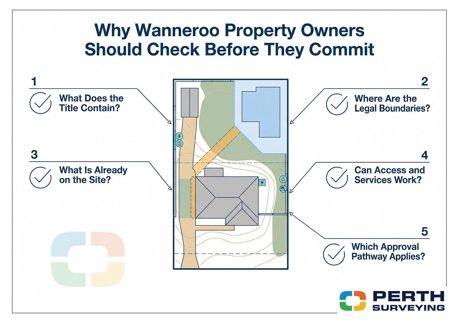
The following five questions provide a practical starting point.
Five Questions Wanneroo Homeowner Developers Should Ask
For many Wanneroo property owners, subdivision begins with a simple thought: there appears to be enough unused land beside or behind the existing home.
Many subdivision ideas begin with apparently unused land beside or behind an existing home. Before treating that space as a development opportunity, the title, boundaries, access, site conditions and approval pathway need to be understood.
Before paying for detailed plans or making financial decisions based on a future lot, you need to understand the property as it actually exists. Boundaries, title restrictions, access, existing buildings, levels, services and approvals may all affect what can be achieved.
Start with these five questions.
What Does the Property Title Contain?
The property title identifies the legal lot and may show easements, restrictions or other matters that affect what can be built.
Some are straightforward. Others may need to be reviewed by a surveyor, planner or property professional before the design proceeds. Perth Surveying can identify title and survey matters relevant to the proposed survey scope; legal interpretation of covenants or registered interests may require advice from a solicitor, conveyancer or planner. An easement may influence where a driveway, building or service connection can be placed. A covenant may contain conditions relevant to the proposed development.
A current title search and the available survey records can help establish:
- The legal description of the property
- Recorded lot dimensions
- Registered easements or interests
- Existing survey information
- Matters requiring further professional advice
Not every notation will prevent development. But it should be understood before plans are prepared around assumptions.
Where Are the Legal Boundaries?
Do not assume the fence marks the legal boundary. If the proposed driveway, dwelling or new lot depends on the full width of the property, the boundary should be properly established before the design is finalised.
Even a small difference may affect:
- Side access
- Building setbacks
- Proposed lot area
- Driveway design
- Retaining walls
- Existing structures near the boundary
Legal boundaries should be established from survey evidence rather than fences, online maps or owner measurements.
What Is Already on the Site?
A development concept must work around the property as it exists.
The position of the existing home is especially important when the owner hopes to retain it and create a new lot. Sheds, patios, pools, driveways, retaining walls, trees and changes in ground level may also influence the available space.
A feature and contour survey can record relevant information such as:
- The existing home and outbuildings
- Fences and retaining walls
- Driveways and paved areas
- Ground levels and slopes
- Significant trees and visible site features
- The relationship between improvements and the boundaries
The resulting plan gives the designer or planner a clear base for testing the concept. The position of the home, outbuildings, retaining walls or changes in level may determine whether the original layout needs to be revised.
Can Practical Access and Services Be Provided?
A rear lot needs more than enough space on paper. People, vehicles and essential services must also be able to reach it.
Side access should be measured accurately. The available width may be affected by eaves, meter boxes, air-conditioning units, steps, retaining walls or the position of the existing house.
The proposal may also require suitable arrangements for:
- Water
- Sewer
- Power
- Telecommunications
- Stormwater drainage
Service locations may be included where visible or within the agreed survey scope, but availability, capacity and connection requirements should be confirmed with the relevant providers.
Existing services may need to be extended, protected, relocated or upgraded. These requirements can influence the layout and cost of the project.
The practical question is whether the proposed lot can be accessed and serviced without introducing avoidable design, approval or construction costs.
Which Approval Pathway Applies?
Subdivision and development approval are related, but they are not the same process.
Subdivision applications are lodged with the Western Australian Planning Commission, which refers proposals to the City of Wanneroo and other relevant authorities or service providers for comment. Separate development or building approvals may also be required for future construction.
Depending on the property, you may need input from:
- A licensed surveyor
- A town planner
- A building designer or architect
- A civil or structural engineer
- Relevant service providers
- The City of Wanneroo
- The Western Australian Planning Commission
Perth Surveying can explain the surveying and subdivision administration stages, prepare the required survey information and provide clear guidance on the next step. Where another specialist is needed, it is better to establish that early.
A sound development decision begins with five things: a clear title, confirmed boundaries, accurate site information, practical access and an understood approval pathway.
Once those facts are known, you can decide whether to proceed, revise the idea or stop before further money is committed.
Start With the Facts Before You Commit
Not every building or subdivision idea will work exactly as first imagined. A survey shows what is there, what may affect the project, and what information your next consultant will need.
Finding that out early gives you more choices and fewer expensive surprises.
Perth Surveying provides clear advice, confirmed deliverables, and reliable survey scheduling you can plan the next project stage around.
Planning to Build, Fence or Subdivide in Wanneroo?
Send Perth Surveying the property address, a brief description of the proposed work and any plans or consultant requirements. We will recommend the appropriate survey, confirm the deliverables and provide a clear quote with the expected scheduling window.
Call 08 9303 2407
Email sales@perthsurveying.com.au
Visit perthsurveying.com.au
What Happens Next?
- Send us the property address and project details.
- We confirm the appropriate survey scope, deliverables, quote and expected timing.
- Once you complete the quote and payment requirements, we schedule and confirm survey attendance.
FAQs
Do I need a boundary survey before replacing a fence?
A boundary survey is recommended when the legal boundary is unclear, boundary marks are missing, or the existing fence may not be in the correct position. It provides a dependable boundary reference before work begins, reducing the risk of neighbour disputes or having to relocate the new fence.
Can Perth Surveying tell me if my Wanneroo block can be subdivided?
Perth Surveying can review the available property information, explain the surveying work needed to investigate the proposal and identify the next practical step. Subdivision approval is determined by the Western Australian Planning Commission, and planning, servicing or engineering advice may also be required.
How much does a land survey cost in Wanneroo?
Land survey costs depend on the survey type, lot size, site access, existing improvements, available survey records and required turnaround. Send us the property address and project details for a clear, scoped quote and expected timing. Priority or urgent attendance may attract an additional uplift.
How long does a land survey take in Wanneroo?
Timing depends on the survey type, available property records, site access and current scheduling capacity. Perth Surveying confirms the expected attendance and delivery timing before the booking proceeds, giving you a timeframe your builder, designer or planner can work around.
